It's not often that Microsoft does something with its Bing search engine that we can conclusively say is better than Google's effort.
But Bing's new "Streetside" mode definitely is one case -- especially for travellers in unfamiliar cities, trying to locate buildings by sight.
Check out this video from Microsoft Research demonstrating how a prototype of the system (then called "Streetslide") works.
That's a pre-release demo video -- the actual Streetside system now available on Bing is a bit different.
In Google Streetview, although it's amazing technology, you can only move along the street in segments, looking up, down, left and right from a fixed location.
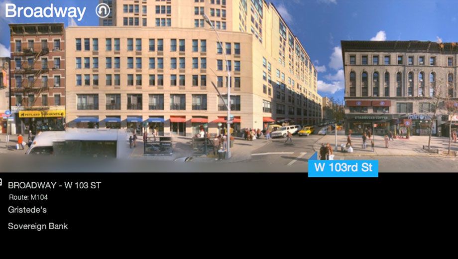
In Microsoft Bing Streetside, you can zoom out from the 'standing' position on the street to view a whole side of a street, panning along it smoothly.
Microsoft overlays company names underneath buildings to help you identify them, and above the Streetside, shows a 2D map of the area.
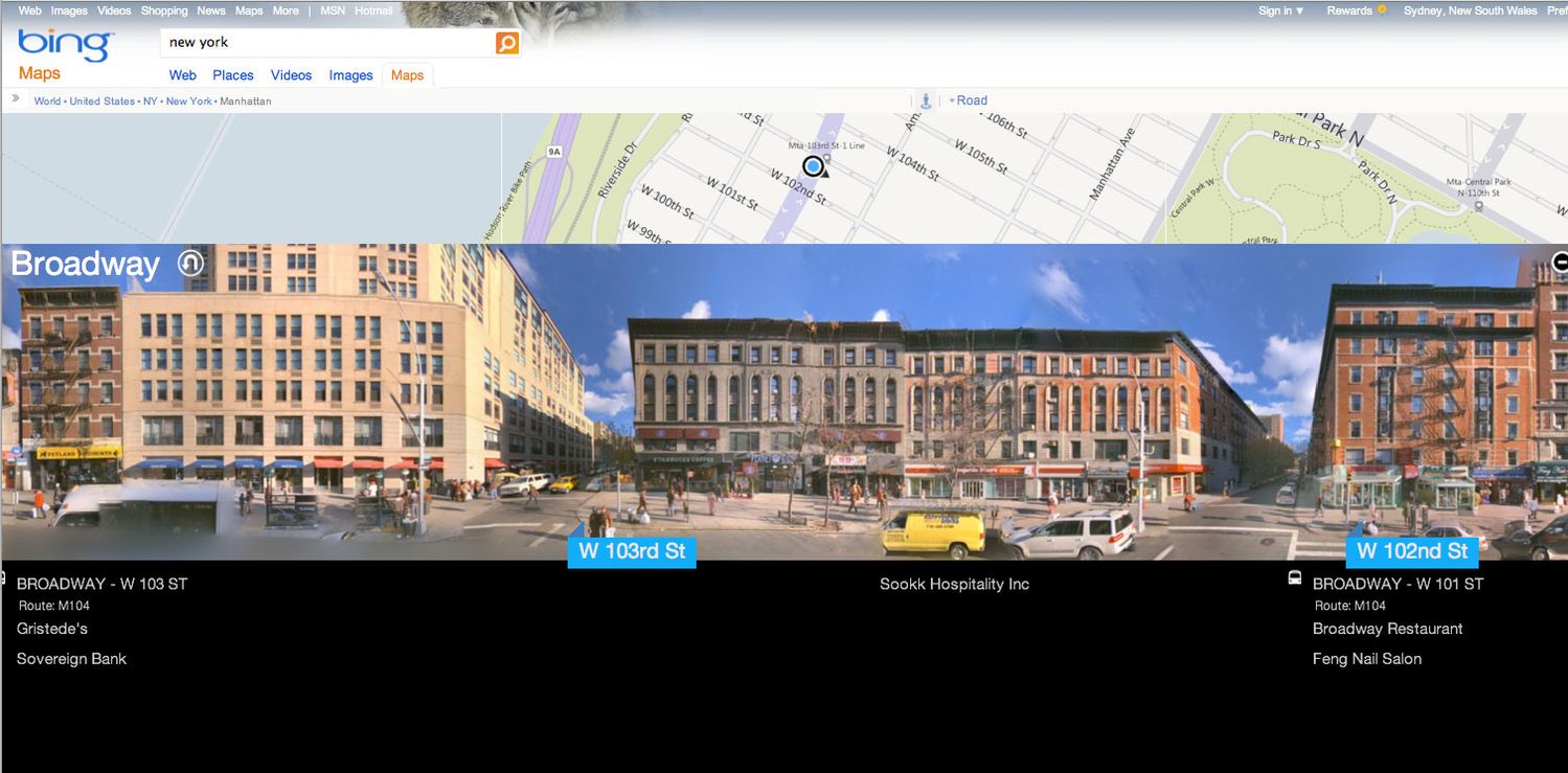
In terms of where you can view Streetside imagery, it's limited to cities in the USA at the moment. Microsoft says it has collected imagery in 56 US metro areas, and also some areas of Canada. Other international areas will be added "soon", according to Microsoft.
The secret sauce behind the system is Microsoft's clever "Photosynth" technology which blends images together. In the past it has been an interesting proof of concept for putting tourist photos of the same place into a 3D scene, but it's great to see Microsoft putting the technology into a practical setting.
Microsoft says it aims to integrate people's random photos of streets into Bing's Streetside photoscapes -- another huge leap forward in the 'crowd-sourcing' of maps.
You can try it out yourself at the Bing Maps Beta website. You'll have to click the "Australia" link at the top of the screen and change to the United States - English site, though. It seems Bing Australia doesn't yet have the Streetside feature. Here's a direct link to a Streetside view in New York.


Qantas - Qantas Frequent Flyer
01 Jun 2011
Total posts 1
After watching the video, which looked quite interesting, I was disappointed to find that most of what might make the Streetside view an actual competitor to Google's StreetView was missing in the final version. I couldn't find any evidence of the "bubbles" idea, and instead can only do the long pans along the street. I couldn't find any way of actually turning down a side street or looking around at a particular spot. How you can make a claim that this is so much better than Streetview is quite perplexing to me.
As far as I can tell, it's a novel idea that makes it different to Google's implementation, but calling it "better"... really? Really??
Qantas
24 Oct 2010
Total posts 177
How interesting. To be honest, I assumed Streetside didn't replace standard Bing street view, which is the "bubbles" thing you're referring to (and is a standard part of Streetview and Bing Maps).
However, now that I look, I can't actually see how to go back into "bubbles" mode either.
In streetside, you can go down a sidestreet -- you just click the name of a street name pointer on the streetside view. (But then, it weirdly takes you down the street looking sideways again, at the side of the street, which does feel strange.)
Qantas
24 Oct 2010
Total posts 177
Ahh. This tweet from Microsoft explains it:
https://twitter.com/bing/status/75698515887665154
Turns out the old 'bubble' view is still there, as a "map app" that you can choose to activate.
That does suck, really. They should have integrated the new streetside into the old streetview as they show in the prototype video.
Qantas
24 Oct 2010
Total posts 177
Still, I'd have to say even though switching between the modes isn't that easy, I still like Bing's streetside more than Google Streetview -- simply because Streetview does make it hard to look at the side of the street while travelling down it. (And Microsoft's imagery is much clearer, brighter and higher resolution -- Google Streetview looks pretty blurry and drab a lot of the time.)
The image merging leaves a bit to be desired with Microsoft though. The Photosynth technology isn't as good as it's touted to be.
11 Feb 2017
Total posts 1
Six years later and I still have no streetside in Bing for my city. I did see the HERE camera vehicle driving around over a year ago so I guess it's in progress but man those guys are not in a hurry at all, are they?
Hi Guest, join in the discussion on Travel tech: Microsoft Streetside beats Google Streetview